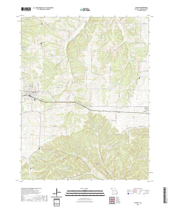
2021 Map of Stover
USGS Topo · Published 2021About this map
Stover serves as the central hub of this Missouri landscape, where the street grid meets a winding network of rural roads and creek drainages. The area is defined by a significant number of family and community burial grounds, including the Hinken Cem in the north and Antioch Cem to the east, which offer vital touchpoints for genealogical research. The terrain is marked by distinctive geological features like the Devils Backbone ridge, while water resources such as Crystal Lake and Mononame 107 Lake provide localized landmarks among the rolling hills.
Find a feature on this map
84 named features on this map. Tap any name to fly to it.
Don’t see what you’re looking for? This feature index may not catch every label — zoom into the map to look around manually.
Map Details
Editions of this 2021 Stover Map
This is the sole edition of this map. No revisions or reprints were ever made.
Other maps of this area

1887 · Sedalia
USGS Topo · 1:125,000

1887 · Warsaw
USGS Topo · 1:125,000

1888 · Versailles
USGS Topo · 1:125,000

1888 · Boonville
USGS Topo · 1:125,000

1893 · Versailles
USGS Topo · 1:125,000

1894 · Warsaw
USGS Topo · 1:125,000

1894 · Sedalia
USGS Topo · 1:125,000

1904 · Gravois Mills
USGS Topo · 1:62,500

1935 · Gravois Mills
USGS Topo · 1:24,000

1935 · Proctor Creek
USGS Topo · 1:24,000