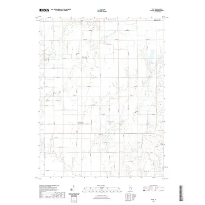
2021 Map of Stoy
USGS Topo · Published 2021About this map
Hardinville and the industrial-named Oil Center anchor this Crawford County landscape, reflecting the rural and extractive heritage of southeastern Illinois. The terrain is defined by a dendritic network of small waterways, including Painter Fork, Honey Cr, and Little Cr, which carve through the agricultural grid. Genealogists will find several significant burial sites across the township, such as Hardinville Cem, Jones Cem, and the Prior Grove Cem. Small settlements like Stoy and Villas are connected by a dense system of county highways and named township roads, illustrating the organized land division and settlement patterns of the region. The proximity to Robinson at the northeastern edge suggests the transition from village life to the larger county seat.
Find a feature on this map
56 named features on this map. Tap any name to fly to it.
Don’t see what you’re looking for? This feature index may not catch every label — zoom into the map to look around manually.
Map Details
Editions of this 2021 Stoy Map
This is the sole edition of this map. No revisions or reprints were ever made.
Other maps of this area

1910 · Hardinville
USGS Topo · 1:62,500

1917 · Birds
USGS Topo · 1:62,500

1942 · Birds
USGS Topo · 1:62,500

1953 · Indianapolis
USGS Topo · 1:250,000

1956 · Indianapolis
USGS Topo · 1:250,000

1956 · Annapolis
USGS Topo · 1:62,500

1956 · Vincennes
USGS Topo · 1:250,000

1957 · Indianapolis
USGS Topo · 1:250,000

1957 · Vincennes
USGS Topo · 1:250,000

1957 · Hutsonville
USGS Topo · 1:62,500