
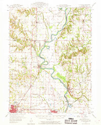
1957 Map of Hutsonville
USGS Topo · Published 1958About this map
The Wabash River serves as the central artery for this mid-century landscape, dividing the riverfront communities of Hutsonville and York on the Illinois side from Fairbanks and Merom in Indiana. The map captures a sophisticated network of water management and transport, featuring the Hutsonville Cutoff and several levees designed to control the river's path through the fertile bottoms. The presence of the Hutsonville Bridge and the Illinois Central Railroad underscores the area's importance as a regional transit corridor.
Find a feature on this map
86 named features on this map. Tap any name to fly to it.
Don’t see what you’re looking for? This feature index may not catch every label — zoom into the map to look around manually.
Map Details
Editions of this 1957 Hutsonville Map
2 editions found
Other maps of this area

1910 · Hardinville
USGS Topo · 1:62,500

1917 · Birds
USGS Topo · 1:62,500

1932 · Marshall
USGS Topo · 1:62,500

1936 · Casey
USGS Topo · 1:48,000

1937 · Marshall
USGS Topo · 1:62,500

1940 · Pimento
USGS Topo · 1:24,000

1942 · Fairbanks
USGS Topo · 1:24,000

1942 · Shelburn
USGS Topo · 1:24,000

1942 · Hutton
USGS Topo · 1:24,000

1942 · Birds
USGS Topo · 1:62,500