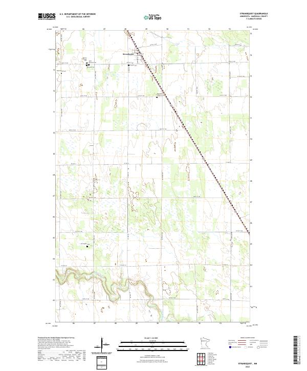
2022 Map of Strandquist
USGS Topo · Published 2022About this map
Strandquist sits at the northern edge of this Marshall County landscape, where the agricultural grid is defined by a dense network of sectional roads and historical congregational burial grounds. The land is characterized by numerous small wetlands and prairie potholes that give way to the meandering course of the Middle River as it winds through the southern reaches of the quadrangle. A distinct cluster of religious and community history is evident around the main settlement, featuring the English Cem, Saint Edwards Cem, and Mission Covenant Cem. This distribution of cemeteries, including the Norwegian Cem and Augustana Lutheran Cem further afield, reflects the diverse denominational heritage and early settlement patterns of the Red River Valley region.
Find a feature on this map
27 named features on this map. Tap any name to fly to it.
Don’t see what you’re looking for? This feature index may not catch every label — zoom into the map to look around manually.
Map Details
Editions of this 2022 Strandquist Map
This is the sole edition of this map. No revisions or reprints were ever made.
Other maps of this area

1919 · Pelan
USGS Topo · 1:62,500

1952 · Thief River Falls
USGS Topo · 1:250,000

1956 · Thief River Falls
USGS Topo · 1:250,000

1956 · Karlstad
USGS Topo · 1:62,500

1956 · Florian
USGS Topo · 1:62,500

1957 · Thief River Falls
USGS Topo · 1:250,000

1957 · Newfolden
USGS Topo · 1:62,500

1957 · Pelan
USGS Topo · 1:62,500

1967 · Thief River Falls
USGS Topo · 1:250,000
1982 · Florian SE
USGS Topo · 1:24,000