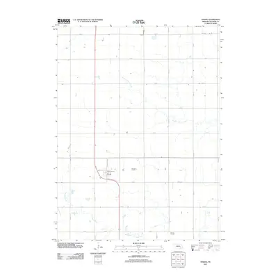
2011 Map of Strang
USGS Topo · Published 2011About this map
Strang serves as the central hub of this agricultural landscape in Fillmore County, where a rigid grid of rural roads meets the diagonal curve of the rail corridor. The village is tightly defined by its proximity to East Strang Junction and the local Strang Post Office, reflecting its role as a small-town service point for the surrounding farms. Notable for genealogists, the map identifies the Harmony Cemetery located in the southern portion of the quadrangle.
Find a feature on this map
24 named features on this map. Tap any name to fly to it.
Don’t see what you’re looking for? This feature index may not catch every label — zoom into the map to look around manually.
Map Details
Editions of this 2011 Strang Map
This is the sole edition of this map. No revisions or reprints were ever made.
Other maps of this area

1898 · York
USGS Topo · 1:125,000

1898 · Hebron
USGS Topo · 1:125,000

1899 · York
USGS Topo · 1:125,000

1955 · Lincoln
USGS Topo · 1:250,000

1957 · Lincoln
USGS Topo · 1:250,000

1958 · Lincoln
USGS Topo · 1:250,000

1960 · Bruning
USGS Topo · 1:24,000

1960 · Carleton
USGS Topo · 1:24,000

1960 · Tobias SW
USGS Topo · 1:24,000
1961 · Ohiowa
USGS Topo · 1:24,000