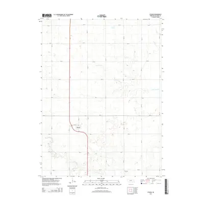
2014 Map of Strang
USGS Topo · Published 2014About this map
Strang sits at the heart of this agricultural landscape in Fillmore County, where the grid of rural section roads meets the curve of Us-81. The village layout is defined by its transit roots, with S Railway St and Main St forming the core of the local settlement. This area of Nebraska is shaped by the subtle drainage of the S Fork Turkey Cr in the north and the winding path of Dry Sandy Cr to the south. Local history is anchored by the Harmony Cem located in the southeastern portion of the map. The landscape is primarily organized by an extensive network of lettered and numbered county roads, such as Road O and Road 17, reflecting the systematic land division that defines the region's farming heritage.
Find a feature on this map
23 named features on this map. Tap any name to fly to it.
Don’t see what you’re looking for? This feature index may not catch every label — zoom into the map to look around manually.
Map Details
Editions of this 2014 Strang Map
This is the sole edition of this map. No revisions or reprints were ever made.
Other maps of this area

1898 · York
USGS Topo · 1:125,000

1898 · Hebron
USGS Topo · 1:125,000

1899 · York
USGS Topo · 1:125,000

1955 · Lincoln
USGS Topo · 1:250,000

1957 · Lincoln
USGS Topo · 1:250,000

1958 · Lincoln
USGS Topo · 1:250,000

1960 · Bruning
USGS Topo · 1:24,000

1960 · Carleton
USGS Topo · 1:24,000

1960 · Tobias SW
USGS Topo · 1:24,000
1961 · Ohiowa
USGS Topo · 1:24,000