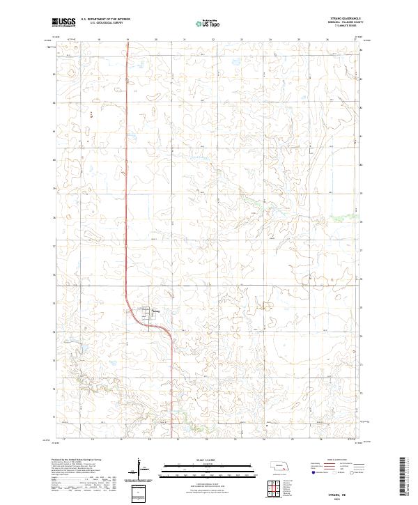
2021 Map of Strang
USGS Topo · Published 2021About this map
Strang sits at the junction of several regional routes, serving as a concentrated point of settlement within the agricultural expanse of Fillmore County. This 2021 survey illustrates the town's grid, anchored by Main St and S Railway St, which reflect the community's historical orientation toward the local transit corridor. The surrounding landscape is defined by the branching tributaries of S Fork Turkey Cr and Dry Sandy Cr, which create subtle topographic variations across the otherwise orderly sections. Outside the town limits, the Harmony Cem stands as a significant landmark for those researching family history in the area, situated along the rural section lines that define the region's land use. The map clearly delineates the township and range boundaries, including t6n r3w, t6n r2w, t5n r3w, and t5n r2w, which provide a geographic framework for tracing land ownership and legacy farmsteads.
Find a feature on this map
19 named features on this map. Tap any name to fly to it.
Don’t see what you’re looking for? This feature index may not catch every label — zoom into the map to look around manually.
Map Details
Editions of this 2021 Strang Map
This is the sole edition of this map. No revisions or reprints were ever made.
Other maps of this area

1898 · York
USGS Topo · 1:125,000

1898 · Hebron
USGS Topo · 1:125,000

1899 · York
USGS Topo · 1:125,000

1955 · Lincoln
USGS Topo · 1:250,000

1957 · Lincoln
USGS Topo · 1:250,000

1958 · Lincoln
USGS Topo · 1:250,000

1960 · Bruning
USGS Topo · 1:24,000

1960 · Carleton
USGS Topo · 1:24,000

1960 · Tobias SW
USGS Topo · 1:24,000
1961 · Ohiowa
USGS Topo · 1:24,000