
1967 Map of Strange Island
USGS Topo · Published 1967About this map
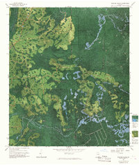
The Okefenokee Swamp dominates this landscape, where early 1960s photogrammetric methods reveal the intricate network of water and land in Clinch and Ware counties. The map captures a transition in land use, showing the legacy of the timber industry through a Dismantled Tram and Dismantled Tram Logging routes that once penetrated deep into the wetlands. These former industrial paths contrast with the preservation of the Okefenokee National Wildlife Refuge.
Find a feature on this map
23 named features on this map. Tap any name to fly to it.
Don’t see what you’re looking for? This feature index may not catch every label — zoom into the map to look around manually.
Map Details
Editions of this 1967 Strange Island Map
2 editions found
Other maps of this area

1954 · Valdosta
USGS Topo · 1:250,000

1955 · Council
USGS Topo · 1:24,000

1956 · Eddy
USGS Topo · 1:24,000

1956 · Sargent
USGS Topo · 1:24,000

1958 · Valdosta
USGS Topo · 1:250,000

1959 · Valdosta
USGS Topo · 1:250,000

1965 · Blackjack Island
USGS Topo · 1:24,000
1966 · Billys Island
USGS Topo · 1:24,000

1966 · The Pocket
USGS Topo · 1:24,000

1967 · Colon
USGS Topo · 1:24,000