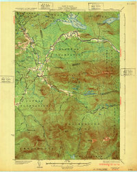
1932 Map of Stratton
USGS Topo · Published 1932About this map
Bigelow Mountain dominates the center of this western Maine landscape, anchoring a wilderness marked by plantations and remote riverside settlements before mid-century reservoir projects altered the terrain. The Dead River and its branches, including the South Branch Dead River, provide the primary drainage for the high peaks of the Redington Pond Range and summits like Sugarloaf Mtn. Early 20th-century life is concentrated in the small villages of Stratton, Eustis, and Flagstaff, the latter of which still occupies its original valley location.
Find a feature on this map
69 named features on this map. Tap any name to fly to it.
Don’t see what you’re looking for? This feature index may not catch every label — zoom into the map to look around manually.
Map Details
Editions of this 1932 Stratton Map
3 editions found

Other maps of this area

1925 · Pierce Pond
USGS Topo · 1:48,000

1927 · Pierce Pond
USGS Topo · 1:62,500

1928 · Chain Lakes
USGS Topo · 1:48,000

1928 · Spencer
USGS Topo · 1:48,000

1928 · Dead River
USGS Topo · 1:62,500

1928 · Stratton
USGS Topo · 1:48,000

1929 · Phillips
USGS Topo · 1:48,000

1930 · Kingfield
USGS Topo · 1:48,000

1931 · Dead River
USGS Topo · 1:48,000

1932 · Phillips
USGS Topo · 1:62,500