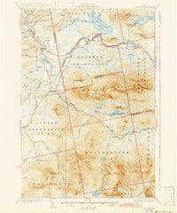
1932 Map of Stratton
USGS Topo · Published 1943About this map
The Dead River meanders through the heart of this Maine landscape as it appeared in the late 1920s, showing the region before modern developments significantly altered the river valley. The village of Flagstaff sits at a critical junction near Flagstaff Lake, a community and topography that would later be transformed by hydroelectric projects. To the south, the massive profile of Bigelow Mountain dominates the horizon, featuring Cranberry Peak and The Horns.
Find a feature on this map
69 named features on this map. Tap any name to fly to it.
Don’t see what you’re looking for? This feature index may not catch every label — zoom into the map to look around manually.
Map Details
Editions of this 1932 Stratton Map
3 editions found

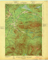
Other maps of this area

1925 · Pierce Pond
USGS Topo · 1:48,000

1927 · Pierce Pond
USGS Topo · 1:62,500

1928 · Chain Lakes
USGS Topo · 1:48,000

1928 · Spencer
USGS Topo · 1:48,000

1928 · Dead River
USGS Topo · 1:62,500

1928 · Stratton
USGS Topo · 1:48,000

1929 · Phillips
USGS Topo · 1:48,000

1930 · Kingfield
USGS Topo · 1:48,000

1931 · Dead River
USGS Topo · 1:48,000

1932 · Phillips
USGS Topo · 1:62,500