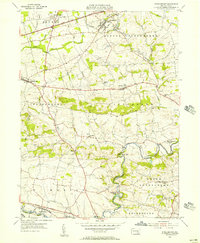
1955 Map of Strausstown
USGS Topo · Published 1957About this map
Tulpehocken Creek meanders through this mid-century landscape, tracing a path through the townships of Bethel, Jefferson, and Marion. The map captures the remnants of the Union Canal as it follows the creek bed, providing a clear record of 19th-century transport infrastructure preserved into the 1950s. Rural life is anchored by traditional centers of community, from the St Johns Ch near Host to the industrial history evident at Charming Forge.
Find a feature on this map
37 named features on this map. Tap any name to fly to it.
Don’t see what you’re looking for? This feature index may not catch every label — zoom into the map to look around manually.
Map Details
Editions of this 1955 Strausstown Map
4 editions found
Other maps of this area

1889 · Pottsville
USGS Topo · 1:62,500

1891 · Pottsville
USGS Topo · 1:62,500

1891 · Lebanon
USGS Topo · 1:62,500

1892 · Pine Grove
USGS Topo · 1:62,500

1893 · Lebanon
USGS Topo · 1:62,500

1899 · Lebanon
USGS Topo · 1:62,500

1902 · Wernersville
USGS Topo · 1:62,500

1943 · Lebanon
USGS Topo · 1:62,500

1943 · Wernersville
USGS Topo · 1:62,500

1945 · Friedensburg
USGS Topo · 1:24,000
Featured Places
- Bethel Township, PA
- North Heidelberg Township, PA
- Strausstown, Upper Tulpehocken Township
- Heidelberg Township, PA
- Jefferson Township, PA