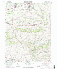
1955 Map of Strausstown
USGS Topo · Published 1977About this map
Tulpehocken Creek and its many tributaries wind through this Berks County landscape, defining the rural development of the mid-20th century. The waterway's industrial past is visible at Charming Forge and Kricks Mill, while the remnants of early transportation are marked by the Union Canal Creek and Pulpehocken Canal Creek. These features suggest a landscape once heavily reliant on water power and canal transit before shifting toward the modern road networks seen here.
Find a feature on this map
37 named features on this map. Tap any name to fly to it.
Don’t see what you’re looking for? This feature index may not catch every label — zoom into the map to look around manually.
Map Details
Editions of this 1955 Strausstown Map
4 editions found
Other maps of this area

1889 · Pottsville
USGS Topo · 1:62,500

1891 · Pottsville
USGS Topo · 1:62,500

1891 · Lebanon
USGS Topo · 1:62,500

1892 · Pine Grove
USGS Topo · 1:62,500

1893 · Lebanon
USGS Topo · 1:62,500

1899 · Lebanon
USGS Topo · 1:62,500

1902 · Wernersville
USGS Topo · 1:62,500

1943 · Lebanon
USGS Topo · 1:62,500

1943 · Wernersville
USGS Topo · 1:62,500

1945 · Friedensburg
USGS Topo · 1:24,000
Featured Places
- Bethel Township, PA
- North Heidelberg Township, PA
- Strausstown, Upper Tulpehocken Township
- Heidelberg Township, PA
- Jefferson Township, PA