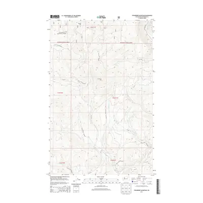
2014 Map of Strawberry Mountain
USGS Topo · Published 2014About this map
The Okanogan National Forest and the Colville Indian Reservation intersect in this high-elevation landscape of the Sanpoil River drainage. Dominated by Strawberry Mtn and Dugout Mtn, the terrain is defined by a dense network of mountain streams including Strawberry Cr, Stepstone Cr, and Gold Cr that feed into the larger water systems of the region. The map captures the specialized Bureau of Indian Affairs road network, with routes such as BIA 66 Rd and BIA 1025 Rd winding through the reservation lands to provide access to these remote slopes. Along the eastern edge, the W Fork Sanpoil River runs parallel to Aeneas Valley Rd, marking a primary corridor for transit through the mountain pass. This 2014 survey documents the modern boundaries and land management divisions within this section of Okanogan County.
Find a feature on this map
25 named features on this map. Tap any name to fly to it.
Don’t see what you’re looking for? This feature index may not catch every label — zoom into the map to look around manually.
Map Details
Editions of this 2014 Strawberry Mountain Map
This is the sole edition of this map. No revisions or reprints were ever made.
Other maps of this area

1902 · Osoyoos
USGS Topo · 1:125,000

1904 · Osoyoos
USGS Topo · 1:125,000

1904 · Republic
USGS Topo · 1:125,000

1951 · Wauconda
USGS Topo · 1:62,500

1952 · Disautel
USGS Topo · 1:62,500

1953 · Bald Knob
USGS Topo · 1:62,500

1954 · Okanogan
USGS Topo · 1:250,000

1957 · Aeneas Valley
USGS Topo · 1:62,500

1958 · Okanogan
USGS Topo · 1:250,000

1958 · Aeneas
USGS Topo · 1:62,500