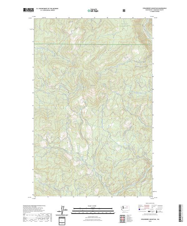
2023 Map of Strawberry Mountain
USGS Topo · Published 2023About this map
Okanogan National Forest encompasses this high-elevation terrain, where the topography is defined by the prominent crests of Strawberry Mtn and Dugout Mtn. This contemporary 2023 survey illustrates the complex drainage patterns of the Colville Indian Reservation and surrounding forest lands. A network of Bureau of Indian Affairs routes, including Bia Rd 66 and Bia RD 70, provides the primary access through these wooded highlands.
Find a feature on this map
24 named features on this map. Tap any name to fly to it.
Don’t see what you’re looking for? This feature index may not catch every label — zoom into the map to look around manually.
Map Details
Editions of this 2023 Strawberry Mountain Map
This is the sole edition of this map. No revisions or reprints were ever made.
Other maps of this area

1902 · Osoyoos
USGS Topo · 1:125,000

1904 · Osoyoos
USGS Topo · 1:125,000

1904 · Republic
USGS Topo · 1:125,000

1951 · Wauconda
USGS Topo · 1:62,500

1952 · Disautel
USGS Topo · 1:62,500

1953 · Bald Knob
USGS Topo · 1:62,500

1954 · Okanogan
USGS Topo · 1:250,000

1957 · Aeneas Valley
USGS Topo · 1:62,500

1958 · Okanogan
USGS Topo · 1:250,000

1958 · Aeneas
USGS Topo · 1:62,500