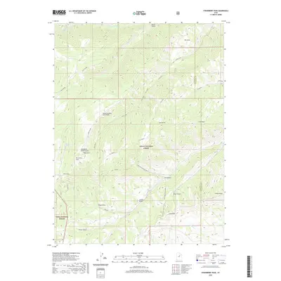
2020 Map of Strawberry Peak
USGS Topo · Published 2020About this map
Strawberry Peak and its neighboring Strawberry North Summit dominate this section of the western Uintah Basin, situated along the border of Ashley National Forest and the Uinta National Forest. The landscape is defined by a complex network of high ridges and deep drainages, notably Twelve Hundred Dollar Ridge and the winding Strawberry River in the northern reaches. The terrain is marked by numerous family or descriptively named hollows and canyons, such as Timber Canyon, Jackson Hollow, and Beaver Canyon.
Find a feature on this map
27 named features on this map. Tap any name to fly to it.
Don’t see what you’re looking for? This feature index may not catch every label — zoom into the map to look around manually.
Map Details
Editions of this 2020 Strawberry Peak Map
This is the sole edition of this map. No revisions or reprints were ever made.
Other maps of this area

1885 · Salt Lake
USGS Topo · 1:250,000

1885 · Manti
USGS Topo · 1:250,000

1885 · Uinta
USGS Topo · 1:250,000

1886 · Price River
USGS Topo · 1:250,000

1895 · Manti
USGS Topo · 1:250,000

1896 · Price River
USGS Topo · 1:250,000

1907 · Strawberry Valley
USGS Topo · 1:125,000

1909 · Strawberry Valley
USGS Topo · 1:125,000

1939 · Soldier Summit
USGS Topo · 1:62,500

1942 · Soldier Summit
USGS Topo · 1:62,500