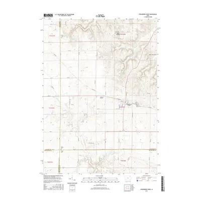
2015 Map of Strawberry Point
USGS Topo · Published 2015About this map
Strawberry Point serves as the primary hub in this corner of Northeast Iowa, situated where multiple township and county lines converge. The map documents a landscape defined by the upper reaches of the Maquoketa River and its varied tributaries, including Fenchel Cr and Kleinlein Cr. The terrain transitions from the open agricultural fields of the western sections into the more dissected topography of Cedar Wood Hills and Sugar Camp Hollow to the east.
Find a feature on this map
57 named features on this map. Tap any name to fly to it.
Don’t see what you’re looking for? This feature index may not catch every label — zoom into the map to look around manually.
Map Details
Editions of this 2015 Strawberry Point Map
This is the sole edition of this map. No revisions or reprints were ever made.
Other maps of this area

1901 · Oelwein
USGS Topo · 1:125,000

1902 · Elkader
USGS Topo · 1:125,000

1959 · Dubuque
USGS Topo · 1:250,000

1961 · Dubuque
USGS Topo · 1:250,000

1962 · Dubuque
USGS Topo · 1:250,000

1964 · Edgewood
USGS Topo · 1:24,000
1964 · Elkader
USGS Topo · 1:24,000

1965 · Wadena
USGS Topo · 1:24,000

1965 · Thorpe
USGS Topo · 1:24,000

1965 · Strawberry Point
USGS Topo · 1:24,000