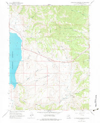
1966 Map of Strawberry Reservoir NE
USGS Topo · Published 1984About this map
Strawberry Reservoir dominates the western edge of this Wasatch County landscape, its 1960s shoreline documented shortly before major water reclamation projects further altered the region. The map reveals a rugged backcountry network defined by Windy Ridge and the Strawberry River, where topographical data includes underwater contours provided by the U.S. Bureau of Reclamation. This focus on water management is punctuated by specific technical markers like the Spillway Elev 7558 and The Narrows. Beyond the reservoir, the land is characterized by steep canyons and seasonal water sources, including Stinking Springs, Chicken Spring, and Soldier Springs. Historically, the area relied on a sparse infrastructure of Telephone lines and Jeep Trails, supporting high-altitude livestock management as evidenced by various corrals scattered throughout the drainage basins of North Fork Deep Creek and Sage Creek.
Find a feature on this map
73 named features on this map. Tap any name to fly to it.
Don’t see what you’re looking for? This feature index may not catch every label — zoom into the map to look around manually.
Map Details
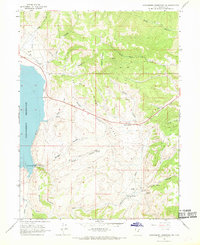
Editions of this 1966 Strawberry Reservoir NE Map
2 editions found
Other maps of this area

1885 · Salt Lake
USGS Topo · 1:250,000

1885 · Uinta
USGS Topo · 1:250,000

1907 · Strawberry Valley
USGS Topo · 1:125,000

1909 · Strawberry Valley
USGS Topo · 1:125,000

1954 · Salt Lake City
USGS Topo · 1:250,000

1958 · Salt Lake City
USGS Topo · 1:250,000

1960 · Salt Lake City
USGS Topo · 1:250,000

1962 · Deep Creek Canyon
USGS Topo · 1:24,000

1962 · Raspberry Knoll
USGS Topo · 1:24,000
1962 · Strawberry Peak
USGS Topo · 1:24,000