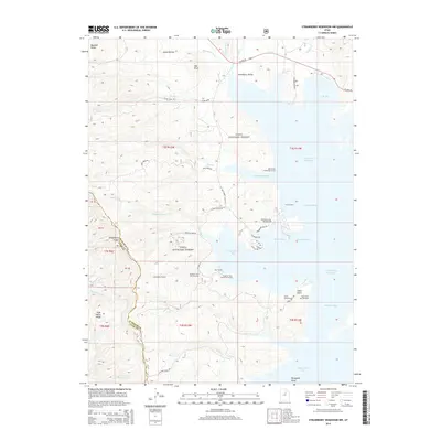
2014 Map of Strawberry Reservoir NW
USGS Topo · Published 2014About this map
Strawberry Reservoir dominates the eastern half of this landscape, its intricate shoreline forming numerous named inlets including Mosquito Bay, Badger Bay, and Indian Creek Bay. Situated within the Uinta National Forest, the region serves as a significant recreational and water management hub. Infrastructure such as the Strawberry Tunnel and the East Portal reflect the area's role in diverted water transport, while the western portion of the map is defined by the high elevations of the Wasatch Range and Fifth Water Ridge. Local access is provided by a network of forest roads like Squaw Creek Rd and Mud Creek Rd, which connect various shorefront points. For outdoor enthusiasts and researchers, the map identifies specific facilities including the Strawberry Bay Campground and several specialized areas like Mud Creek Fisherman Access and Haws Point Day Use Area.
Find a feature on this map
57 named features on this map. Tap any name to fly to it.
Don’t see what you’re looking for? This feature index may not catch every label — zoom into the map to look around manually.
Map Details
Editions of this 2014 Strawberry Reservoir NW Map
This is the sole edition of this map. No revisions or reprints were ever made.
Other maps of this area

1885 · Salt Lake
USGS Topo · 1:250,000

1907 · Strawberry Valley
USGS Topo · 1:125,000

1909 · Strawberry Valley
USGS Topo · 1:125,000

1954 · Salt Lake City
USGS Topo · 1:250,000

1958 · Salt Lake City
USGS Topo · 1:250,000

1960 · Salt Lake City
USGS Topo · 1:250,000

1966 · Strawberry Reservoir NW
USGS Topo · 1:24,000
1966 · Strawberry Reservoir NE
USGS Topo · 1:24,000
1966 · Strawberry Reservoir SW
USGS Topo · 1:24,000

1967 · Two Tom Hill
USGS Topo · 1:24,000