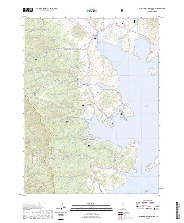
2023 Map of Strawberry Reservoir NW
USGS Topo · Published 2023About this map
Strawberry Reservoir dominates the eastern half of this terrain, its intricate shoreline defined by prominent landmarks like Haws Point and Renegade Point. Set within the Uinta National Forest, the landscape transitions from the high peaks of the Wasatch Range to the broad expanse of Strawberry Valley. This modern survey illustrates the extensive recreational and management infrastructure in the region, particularly the network of seasonal routes such as the Clyde Creek Loop Snowmo Groomed Trl and Mud Creek Snowmo Groomed Trl.
Find a feature on this map
43 named features on this map. Tap any name to fly to it.
Don’t see what you’re looking for? This feature index may not catch every label — zoom into the map to look around manually.
Map Details
Editions of this 2023 Strawberry Reservoir NW Map
This is the sole edition of this map. No revisions or reprints were ever made.
Other maps of this area

1885 · Salt Lake
USGS Topo · 1:250,000

1907 · Strawberry Valley
USGS Topo · 1:125,000

1909 · Strawberry Valley
USGS Topo · 1:125,000

1954 · Salt Lake City
USGS Topo · 1:250,000

1958 · Salt Lake City
USGS Topo · 1:250,000

1960 · Salt Lake City
USGS Topo · 1:250,000

1966 · Strawberry Reservoir NW
USGS Topo · 1:24,000
1966 · Strawberry Reservoir NE
USGS Topo · 1:24,000
1966 · Strawberry Reservoir SW
USGS Topo · 1:24,000

1967 · Two Tom Hill
USGS Topo · 1:24,000