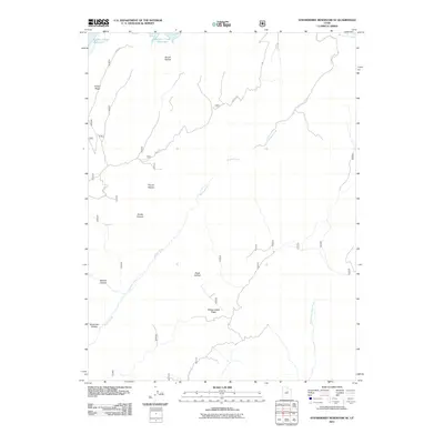
2011 Map of Strawberry Reservoir SE
USGS Topo · Published 2011About this map
Soldier Creek Reservoir anchors the northern reaches of this high-elevation landscape in Wasatch County, where the headwaters of the Strawberry River and Willow Creek carve through a network of steep canyons and ridges. This 2011 survey documents a terrain defined by its complex drainage systems, including the Right Fork White River flowing through the southeastern corner. The map illustrates a remote wilderness character where numerous named geographic features such as French Hollow, Broad Hollow, and Poison Ridge suggest a history of seasonal use and topographic navigation. For those tracing regional land use, the extensive Forest Road system provides the primary access through this territory, connecting remote points like Buffalo Canyon and Racetrack Hollow across the Willow Creek Ridge.
Find a feature on this map
32 named features on this map. Tap any name to fly to it.
Don’t see what you’re looking for? This feature index may not catch every label — zoom into the map to look around manually.
Map Details
Editions of this 2011 Strawberry Reservoir SE Map
This is the sole edition of this map. No revisions or reprints were ever made.
Other maps of this area

1885 · Salt Lake
USGS Topo · 1:250,000

1885 · Manti
USGS Topo · 1:250,000

1885 · Uinta
USGS Topo · 1:250,000

1886 · Price River
USGS Topo · 1:250,000

1895 · Manti
USGS Topo · 1:250,000

1896 · Price River
USGS Topo · 1:250,000

1907 · Strawberry Valley
USGS Topo · 1:125,000

1909 · Strawberry Valley
USGS Topo · 1:125,000

1939 · Soldier Summit
USGS Topo · 1:62,500

1942 · Soldier Summit
USGS Topo · 1:62,500