
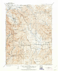
1907 Map of Strawberry Valley
USGS Topo · Published 1955About this map
Round Valley and the surrounding high country of Wasatch County are documented here during a period of early surveying between 1903 and 1907. Small agricultural communities such as Charleston and Wallsburg anchor the western portion of the sheet, while the rugged interior is defined by deep canyons like Daniels Canyon and the winding course of the Strawberry River. This area shows the early infrastructure of the region, including the D and R G RR rail line following the Provo River and isolated high-altitude outposts like Averetts Ranch.
Find a feature on this map
86 named features on this map. Tap any name to fly to it.
Don’t see what you’re looking for? This feature index may not catch every label — zoom into the map to look around manually.
Map Details
Editions of this 1907 Strawberry Valley Map
2 editions found
Other maps of this area

1885 · Salt Lake
USGS Topo · 1:250,000

1885 · Manti
USGS Topo · 1:250,000

1885 · Uinta
USGS Topo · 1:250,000

1886 · Price River
USGS Topo · 1:250,000

1895 · Manti
USGS Topo · 1:250,000

1896 · Price River
USGS Topo · 1:250,000

1900 · Coalville
USGS Topo · 1:125,000

1901 · Hayden Peak
USGS Topo · 1:125,000

1903 · Hayden Peak
USGS Topo · 1:125,000

1903 · Coalville
USGS Topo · 1:125,000