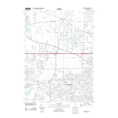
2012 Map of Streamwood
USGS Topo · Published 2012About this map
Streamwood and its surrounding suburbs are meticulously detailed in this 2012 survey, revealing the complex residential development patterns of northwest Illinois. The map captures a high-density suburban landscape interwoven with specialized facilities like the Maywood Park Training Track and the Mill Rose Farm (RLA) Airport. These sites, alongside leisure spaces such as the Streamwood Oaks Golf Course, illustrate the land-use shifts in Kane and Cook counties. Smaller, older hubs like Barrington Center and Sutton appear as foundational points within the modern grid. Hydrological features including Lake of the Coves, Penny Road Pond, and Crabtree Lake provide local drainage and aesthetic character amidst the dense network of named residential streets. Local history is anchored by sites like Union Cem and Greve Cem, which stand as quiet markers of the area's earlier rural identity.
Find a feature on this map
284 named features on this map. Tap any name to fly to it.
Don’t see what you’re looking for? This feature index may not catch every label — zoom into the map to look around manually.
Map Details
Editions of this 2012 Streamwood Map
This is the sole edition of this map. No revisions or reprints were ever made.
Other maps of this area

1908 · Wheaton
USGS Topo · 1:62,500

1923 · Barrington
USGS Topo · 1:62,500

1925 · Elgin
USGS Topo · 1:62,500

1932 · Geneva
USGS Topo · 1:62,500

1935 · Barrington
USGS Topo · 1:62,500

1940 · Elgin
USGS Topo · 1:62,500

1948 · Wheaton
USGS Topo · 1:62,500

1948 · Geneva
USGS Topo · 1:62,500

1949 · Geneva
USGS Topo · 1:24,000

1953 · West Chicago
USGS Topo · 1:24,000