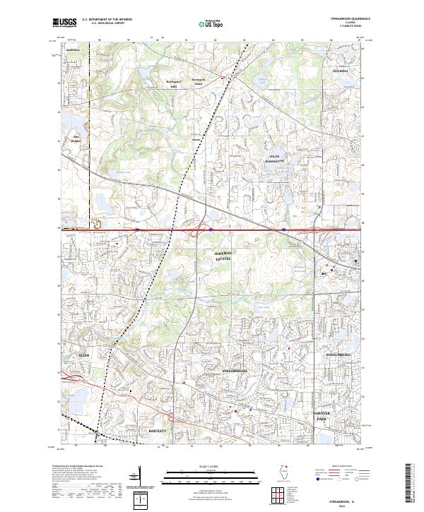
2024 Map of Streamwood
USGS Topo · Published 2024About this map
Streamwood and its neighboring villages in northwest Cook County are defined by a landscape of planned residential expansion interspersed with expansive conservation areas. The Poplar Creek Forest Preserve and Shoe Factory Woods create a significant green belt that separates the denser suburban grids of Hoffman Estates and Schaumburg from the more estate-oriented terrain of Barrington Hills and South Barrington. This contemporary layout preserves natural features like the Bluff Spring Fen and the West Branch Du Page River, illustrating a modern approach to urban planning where major thoroughfares like Golf Rd and Higgins Rd provide the primary structural framework. Local history is anchored by landmarks such as the Greve Cem and the Lakewood Memorial Park, while the Metra line connects these communities to the broader regional economy.
Find a feature on this map
58 named features on this map. Tap any name to fly to it.
Don’t see what you’re looking for? This feature index may not catch every label — zoom into the map to look around manually.
Map Details
Editions of this 2024 Streamwood Map
This is the sole edition of this map. No revisions or reprints were ever made.
Other maps of this area

1908 · Wheaton
USGS Topo · 1:62,500

1923 · Barrington
USGS Topo · 1:62,500

1925 · Elgin
USGS Topo · 1:62,500

1932 · Geneva
USGS Topo · 1:62,500

1935 · Barrington
USGS Topo · 1:62,500

1940 · Elgin
USGS Topo · 1:62,500

1948 · Wheaton
USGS Topo · 1:62,500

1948 · Geneva
USGS Topo · 1:62,500

1949 · Geneva
USGS Topo · 1:24,000

1953 · West Chicago
USGS Topo · 1:24,000