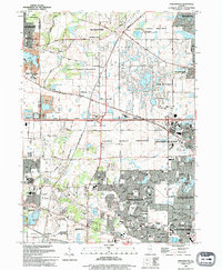
1993 Map of Streamwood
USGS Topo · Published 1994About this map
Streamwood and Hoffman Estates appear here during a period of significant suburban expansion in the early 1990s. The landscape is a distinct blend of dense residential subdivisions and expansive recreation areas, defined by the numerous County Forest Preserves that break up the grid of residential streets. Civic life is well-documented through the presence of institutions like Streamwood High School and Canton Middle School, alongside landmarks such as the Poplar Creek Theater and the Villa Olivia Country Club.
Find a feature on this map
86 named features on this map. Tap any name to fly to it.
Don’t see what you’re looking for? This feature index may not catch every label — zoom into the map to look around manually.
Map Details
Editions of this 1993 Streamwood Map
This is the sole edition of this map. No revisions or reprints were ever made.
Other maps of this area

1908 · Wheaton
USGS Topo · 1:62,500

1923 · Barrington
USGS Topo · 1:62,500

1925 · Elgin
USGS Topo · 1:62,500

1932 · Geneva
USGS Topo · 1:62,500

1935 · Barrington
USGS Topo · 1:62,500

1940 · Elgin
USGS Topo · 1:62,500

1948 · Wheaton
USGS Topo · 1:62,500

1948 · Geneva
USGS Topo · 1:62,500

1949 · Geneva
USGS Topo · 1:24,000

1953 · West Chicago
USGS Topo · 1:24,000