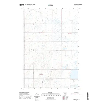
2020 Map of Streeter Flats
USGS Topo · Published 2020About this map
Streeter Flats dominates this portion of Logan County, characterized by a vast network of prairie potholes and wetlands typical of the Missouri Coteau. This landscape, surveyed in the early twenty-first century, reveals a strictly organized section-line road system including 40th Ave SE and 57th St SE that carves the terrain into predictable agricultural blocks despite the irregular water bodies. A significant point of local interest is the Miller Cem, situated in the northeastern quadrant near the boundary of T136n R70w. The map provides a precise look at the township and range divisions, such as T136n R71w and T135n R71w, which continue to define property and governance in this rural North Dakota interior.
Find a feature on this map
18 named features on this map. Tap any name to fly to it.
Don’t see what you’re looking for? This feature index may not catch every label — zoom into the map to look around manually.
Map Details
Editions of this 2020 Streeter Flats Map
This is the sole edition of this map. No revisions or reprints were ever made.
Other maps of this area

1953 · Jamestown
USGS Topo · 1:250,000

1956 · Jamestown
USGS Topo · 1:250,000

1982 · Wishek NE
USGS Topo · 1:24,000

1982 · Burnstad
USGS Topo · 1:24,000

1982 · Lehr NW
USGS Topo · 1:24,000

1983 · Streeter SW
USGS Topo · 1:24,000

1983 · Alkaline Lake SW
USGS Topo · 1:24,000

1983 · Alkaline Lake
USGS Topo · 1:24,000

1983 · Streeter NW
USGS Topo · 1:24,000

1983 · Alkaline Lake NW
USGS Topo · 1:24,000