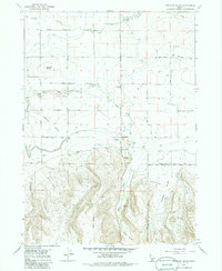
1979 Map of Stricker Butte
USGS Topo · Published 1986About this map
Stricker Cabin sits as a historic waypoint within a landscape defined by the transition from irrigated volcanic plains to the rising draws of the South Hills. The northern half of the area is heavily marked by early 20th-century water engineering, where the Twin Falls Main Canal, High Line Canal, and Low Line Canal snake across the plateau to feed local agriculture. These man-made watercourses contrast sharply with the natural drainage of Rock Creek and Perrine Coulee. To the south, the terrain climbs toward Stricker Butte and Cedar Hill, cut by deep drainages like Niles Gulch and Dry Gulch. The presence of the Rock Creek Cemeteries and various gravel pits suggests a long-standing local community integrated into the land’s geography and resources along the border of Twin Falls and Cassia Counties.
Find a feature on this map
28 named features on this map. Tap any name to fly to it.
Don’t see what you’re looking for? This feature index may not catch every label — zoom into the map to look around manually.
Map Details
Editions of this 1979 Stricker Butte Map
2 editions found
Other maps of this area

1955 · Twin Falls
USGS Topo · 1:250,000

1958 · Twin Falls
USGS Topo · 1:250,000

1964 · Kimberly
USGS Topo · 1:24,000

1964 · Twin Falls
USGS Topo · 1:24,000

1964 · Eden
USGS Topo · 1:24,000

1965 · Rams Horn Ridge
USGS Topo · 1:24,000

1965 · Stricker Butte
USGS Topo · 1:24,000

1965 · Grand View Peak
USGS Topo · 1:24,000

1965 · Hub Butte
USGS Topo · 1:24,000

1965 · Murtaugh
USGS Topo · 1:24,000