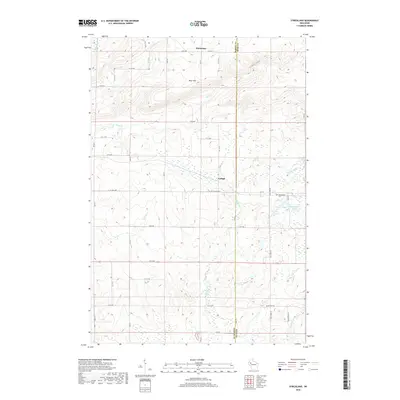
2018 Map of Strickland
USGS Topo · Published 2018About this map
The Blue Hills rise across the northern portion of this landscape, deeply carved by the dramatic Gundys Canyon and multiple drainages including Rock Cr and Silver Cr. This Barron and Rusk County borderland transitions from these high ridges into a lower terrain dominated by a network of creeks and small glacial lakes. The tiny settlement of Lehigh sits centrally, while Horseman occupies the northern reach near Co HWY C. To the southeast, the terrain softens around Little Bowker Lake and Big Bowker Lake, near where the Assumption Cem provides a point of genealogical interest along Co RD W. A grid of rural avenues and local roads like Moose Ear Rd and Old 14 connects these isolated clearings, following the natural flow of Moose Ear Cr and German Cr.
Find a feature on this map
30 named features on this map. Tap any name to fly to it.
Don’t see what you’re looking for? This feature index may not catch every label — zoom into the map to look around manually.
Map Details
Editions of this 2018 Strickland Map
This is the sole edition of this map. No revisions or reprints were ever made.
Other maps of this area

1945 · Meteor
USGS Topo · 1:48,000

1948 · Weyerhauser
USGS Topo · 1:48,000

1949 · Meteor
USGS Topo · 1:48,000

1949 · Rice Lake
USGS Topo · 1:48,000

1950 · Weyerhauser
USGS Topo · 1:48,000

1951 · Rice Lake
USGS Topo · 1:48,000

1951 · Chetek
USGS Topo · 1:62,500

1953 · Rice Lake
USGS Topo · 1:250,000

1959 · Rice Lake
USGS Topo · 1:250,000

1965 · Rice Lake
USGS Topo · 1:62,500