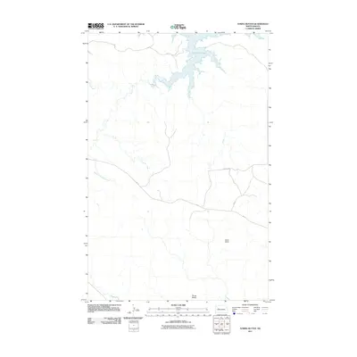
2011 Map of String Buttes
USGS Topo · Published 2011About this map
Lake Sakakawea dominates the northern reaches of this Missouri River plateau landscape, where the inundated shoreline meets the high plains of North Dakota. The terrain is defined by distinct topographical markers such as Heart Butte and the eponymous String Buttes to the south. This 2011 survey by the U.S. Geological Survey maps a network of Bureau of Indian Affairs routes, including Bia 12 and Bia 10, which provide primary access across the prairie. The drainage patterns of Skunk Creek and its tributary, South Fork Skunk Creek, carve through the grasslands, illustrating the natural watercourses that have historically shaped this region's ranching and agricultural potential.
Find a feature on this map
8 named features on this map. Tap any name to fly to it.
Don’t see what you’re looking for? This feature index may not catch every label — zoom into the map to look around manually.
Map Details
Editions of this 2011 String Buttes Map
This is the sole edition of this map. No revisions or reprints were ever made.
Other maps of this area

1953 · Watford City
USGS Topo · 1:250,000

1957 · Watford City
USGS Topo · 1:250,000

1967 · Watford City
USGS Topo · 1:250,000

1967 · Sanish SE
USGS Topo · 1:24,000

1967 · New Town SW
USGS Topo · 1:24,000

1967 · New Town SE
USGS Topo · 1:24,000

1970 · Hay Flat
USGS Topo · 1:24,000

1970 · String Buttes
USGS Topo · 1:24,000
1970 · Saddle Butte
USGS Topo · 1:24,000

1970 · Mandaree SE
USGS Topo · 1:24,000