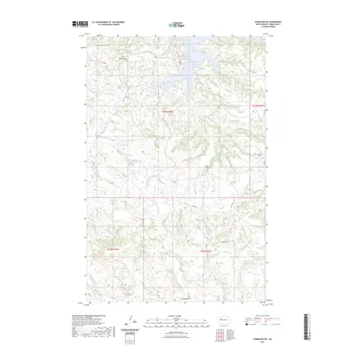
2023 Map of String Buttes
USGS Topo · Published 2023About this map
Two Shields Butte and String Buttes rise above the drainage network of the Fort Berthold Indian Reservation, characterizing this western North Dakota landscape. The map shows the ingress of Skunk Creek Bay on the northern edge, where Skunk Creek and its tributary, South Fork Skunk Creek, feed into the larger reservoir system. To the south, Sakakawea Creek cuts through the terrain near several topographical landmarks, including Heart Butte. Settlement is sparse, anchored by Independence on the eastern boundary. This locality includes a noted Cem, which serves as a vital point of reference for family historians and genealogists researching the residents of Dunn County. The road network is primarily composed of Bureau of Indian Affairs routes, such as BIA Rd 10 and BIA Rd 13, which follow the natural contours of the coulees and high plains.
Find a feature on this map
18 named features on this map. Tap any name to fly to it.
Don’t see what you’re looking for? This feature index may not catch every label — zoom into the map to look around manually.
Map Details
Editions of this 2023 String Buttes Map
This is the sole edition of this map. No revisions or reprints were ever made.
Other maps of this area

1953 · Watford City
USGS Topo · 1:250,000

1957 · Watford City
USGS Topo · 1:250,000

1967 · Watford City
USGS Topo · 1:250,000

1967 · Sanish SE
USGS Topo · 1:24,000

1967 · New Town SW
USGS Topo · 1:24,000

1967 · New Town SE
USGS Topo · 1:24,000

1970 · Hay Flat
USGS Topo · 1:24,000

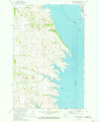
1970 · String Buttes
USGS Topo · 1:24,000
1970 · Saddle Butte
USGS Topo · 1:24,000

1970 · Mandaree SE
USGS Topo · 1:24,000