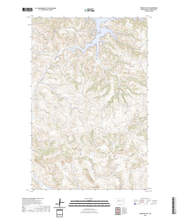
2024 Map of String Buttes
USGS Topo · Published 2024About this map
String Buttes and the high points of Two Shields Butte and Heart Butte dominate this landscape in Dunn County, North Dakota. The terrain is defined by complex drainage patterns, with Skunk Creek and the South Fork Skunk Creek cutting through the topography toward the expansive Skunk Creek Bay. The map provides a modern record of the area's infrastructure, showing the paths of Bureau of Indian Affairs routes like BIA Rte 12 and BIA Rd 10, alongside local names such as Rabbit Rd. For those researching local burial sites and family histories, the Independence Cem is a significant landmark located in the eastern portion of the quadrangle. The intersection of natural watercourses like Sakakawea Creek and the organized Bureau of Indian Affairs road network reflects the modern management of this rural prairie landscape.
Find a feature on this map
17 named features on this map. Tap any name to fly to it.
Don’t see what you’re looking for? This feature index may not catch every label — zoom into the map to look around manually.
Map Details
Editions of this 2024 String Buttes Map
This is the sole edition of this map. No revisions or reprints were ever made.
Other maps of this area

1953 · Watford City
USGS Topo · 1:250,000

1957 · Watford City
USGS Topo · 1:250,000

1967 · Watford City
USGS Topo · 1:250,000

1967 · Sanish SE
USGS Topo · 1:24,000

1967 · New Town SW
USGS Topo · 1:24,000

1967 · New Town SE
USGS Topo · 1:24,000

1970 · Hay Flat
USGS Topo · 1:24,000

1970 · String Buttes
USGS Topo · 1:24,000
1970 · Saddle Butte
USGS Topo · 1:24,000

1970 · Mandaree SE
USGS Topo · 1:24,000