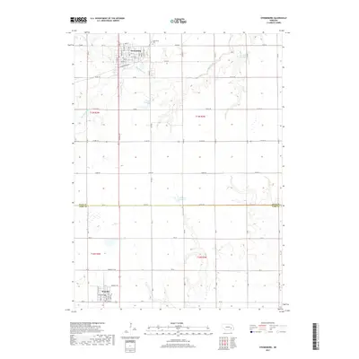
2017 Map of Stromsburg
USGS Topo · Published 2017About this map
Stromsburg serves as the primary hub of this eastern Nebraska landscape, situated just north of the Polk County and York County line. The town's grid is meticulously detailed, showing the intersection of Main St and 9th St, with the Stromsburg Cem located at its northern edge. Southward across the county boundary, the smaller village of Benedict anchors the lower portion of the map.
Find a feature on this map
65 named features on this map. Tap any name to fly to it.
Don’t see what you’re looking for? This feature index may not catch every label — zoom into the map to look around manually.
Map Details
Editions of this 2017 Stromsburg Map
This is the sole edition of this map. No revisions or reprints were ever made.
Other maps of this area

1896 · Stromsburg
USGS Topo · 1:125,000

1898 · York
USGS Topo · 1:125,000

1899 · David City
USGS Topo · 1:125,000

1899 · York
USGS Topo · 1:125,000

1934 · Utica
USGS Topo · 1:62,500

1937 · Utica
USGS Topo · 1:62,500

1955 · Fremont
USGS Topo · 1:250,000

1955 · Lincoln
USGS Topo · 1:250,000

1957 · Fremont
USGS Topo · 1:250,000

1957 · Lincoln
USGS Topo · 1:250,000