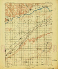
1896 Map of Stromsburg
USGS Topo · Published 1914About this map
Platte River and Loup River dominate this late 19th-century landscape, carving wide, braided channels through the central Nebraska plains. The survey illustrates a region defined by the precision of the section-line grid, where early agricultural townships like Osceola, Stromsburg, and Prairie were taking root alongside vital transportation corridors. The Union Pacific R.R. follows the northern banks of the Loup and Platte, anchoring commercial centers such as Fullerton, Central City, and Silver Creek.
Find a feature on this map
58 named features on this map. Tap any name to fly to it.
Don’t see what you’re looking for? This feature index may not catch every label — zoom into the map to look around manually.
Map Details
Editions of this 1896 Stromsburg Map
5 editions found
Other maps of this area

1896 · Stromsburg
USGS Topo · 1:125,000

1898 · York
USGS Topo · 1:125,000

1898 · Grand Island
USGS Topo · 1:125,000

1899 · David City
USGS Topo · 1:125,000

1899 · St. Paul
USGS Topo · 1:125,000

1899 · York
USGS Topo · 1:125,000

1934 · Utica
USGS Topo · 1:62,500

1937 · Utica
USGS Topo · 1:62,500

1954 · Belgrade
USGS Topo · 1:24,000

1954 · Cedar Rapids SE
USGS Topo · 1:24,000