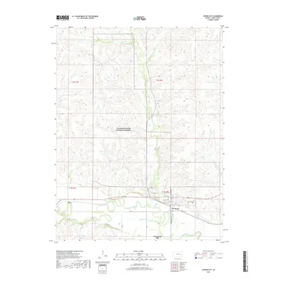
2018 Map of Strong City
USGS Topo · Published 2018About this map
The Tallgrass Prairie National Preserve dominates the flinty hills of Chase County, preserving a massive expanse of the native landscape north of the Cottonwood River. This 2018 survey details the close relationship between the neighboring settlements of Strong City and Cottonwood Falls, which sit along the river's fertile valley. The map reveals a high concentration of cemeteries, including the Strong Township Cem and Saint Anthony Cem, reflecting the deep-rooted community history of this ranching and limestone-quarrying region. To the west, the small locale of Neva marks a point along the transportation corridor that follows the river's winding path. Notable tributaries like Fox Cr and Prather Cr drain the uplands, highlighting the intricate drainage patterns that define the local topography. This modern dataset provides a precise view of rural infrastructure, from Old Hwy 50 to the network of section roads like 220 Rd and 225th Rd that stitch together the open prairie.
Find a feature on this map
34 named features on this map. Tap any name to fly to it.
Don’t see what you’re looking for? This feature index may not catch every label — zoom into the map to look around manually.
Map Details
Editions of this 2018 Strong City Map
This is the sole edition of this map. No revisions or reprints were ever made.
Other maps of this area

1885 · Eskridge
USGS Topo · 1:125,000

1888 · Emporia
USGS Topo · 1:125,000

1889 · Parkerville
USGS Topo · 1:125,000

1889 · Eskridge
USGS Topo · 1:125,000

1894 · Emporia
USGS Topo · 1:125,000

1894 · Eskridge
USGS Topo · 1:125,000

1894 · Parkerville
USGS Topo · 1:125,000

1898 · Cottonwood Falls
USGS Topo · 1:125,000

1955 · Hutchinson
USGS Topo · 1:250,000

1957 · Elmdale
USGS Topo · 1:24,000