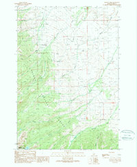
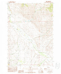
1989 Map of Stroud Creek
USGS Topo · Published 1989About this map
Salmon National Forest and Challis National Forest dominate this high-elevation landscape in eastern Idaho, where steep drainages and canyon walls define the geography. The map reveals an intricate network of watercourses, including the convergence of Patterson Creek, Mill Creek, and Ferry Creek as they flow from the interior mountains. A notable landmark is Everson Lake, situated near the southern boundary in a glacially carved basin above Everson Creek. The inclusion of Devils Canyon and various 4WD tracks suggests a terrain that remained largely inaccessible except to those following primitive routes. This survey, compiled from 1980s photography, documents the wild character of Lemhi County before modern development, marking the presence of a single Radio Tower as a rare sign of modern infrastructure amidst the sprawling drainages of Big Eightmile Creek and Stroud Creek.
Find a feature on this map
25 named features on this map. Tap any name to fly to it.
Don’t see what you’re looking for? This feature index may not catch every label — zoom into the map to look around manually.
Map Details
Editions of this 1989 Stroud Creek Map
This is the sole edition of this map. No revisions or reprints were ever made.
Other maps of this area

1955 · Dubois
USGS Topo · 1:250,000

1956 · Leadore
USGS Topo · 1:62,500

1956 · Patterson
USGS Topo · 1:62,500

1956 · Lemhi
USGS Topo · 1:62,500

1958 · Dubois
USGS Topo · 1:250,000
1965 · Goat Mountain
USGS Topo · 1:24,000

1980 · Leadore
USGS Topo · 1:100,000
1987 · West of Leadore
USGS Topo · 1:24,000
1987 · Sheephorn Peak
USGS Topo · 1:24,000
1989 · Lemhi
USGS Topo · 1:24,000