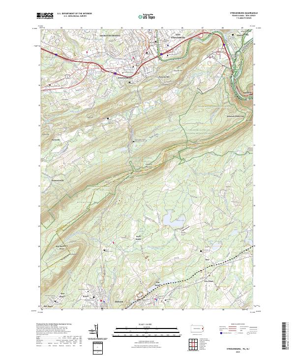
2023 Map of Stroudsburg
USGS Topo · Published 2023About this map
Stroudsburg and East Stroudsburg serve as the hub of this corridor, where the Monroe County Courthouse and East Stroudsburg University anchor the urban landscape. The terrain is defined by the prominent ridge of Kittatinny Mountain, which is breached by the Delaware Water Gap in the northeast. This geological feature has long dictated transport and settlement patterns, with the Pennsylvania New Jersey railroad line following the path carved by the Delaware River.
Find a feature on this map
87 named features on this map. Tap any name to fly to it.
Don’t see what you’re looking for? This feature index may not catch every label — zoom into the map to look around manually.
Map Details
Editions of this 2023 Stroudsburg Map
This is the sole edition of this map. No revisions or reprints were ever made.
Other maps of this area

1891 · Delaware Water Gap
USGS Topo · 1:62,500

1893 · Delaware Water Gap
USGS Topo · 1:62,500

1914 · Wind Gap
USGS Topo · 1:62,500

1916 · Wind Gap
USGS Topo · 1:62,500

1919 · Pocono
USGS Topo · 1:62,500

1921 · Pocono
USGS Topo · 1:62,500

1923 · Pocono
USGS Topo · 1:62,500

1924 · Bushkill
USGS Topo · 1:48,000

1936 · Delaware Water Gap
USGS Topo · 1:48,000

1941 · Delaware Water Gap
USGS Topo · 1:62,500