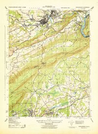
1943 Map of Stroudsburg
USGS Topo · Published 1944About this map
Stroudsburg and East Stroudsburg serve as the industrial and educational heart of this region during the early 1940s, situated at the confluence of Brodhead Creek and Pocono Creek. The map reveals a landscape defined by manufacturing and natural resources, featuring the Mammoth Hosiery Mills, Monroe Silk Mills, and several Slate Quarries to the south near Bangor. Higher education is represented by the State Teachers College, while the iconic Delaware Water Gap marks the dramatic passage of the Delaware River through the Kittatinny Mountains.
Find a feature on this map
88 named features on this map. Tap any name to fly to it.
Don’t see what you’re looking for? This feature index may not catch every label — zoom into the map to look around manually.
Map Details
Editions of this 1943 Stroudsburg Map
This is the sole edition of this map. No revisions or reprints were ever made.
Other maps of this area

1891 · Delaware Water Gap
USGS Topo · 1:62,500

1893 · Delaware Water Gap
USGS Topo · 1:62,500

1914 · Wind Gap
USGS Topo · 1:62,500

1916 · Wind Gap
USGS Topo · 1:62,500

1919 · Pocono
USGS Topo · 1:62,500

1921 · Pocono
USGS Topo · 1:62,500

1923 · Pocono
USGS Topo · 1:62,500

1924 · Bushkill
USGS Topo · 1:48,000

1936 · Delaware Water Gap
USGS Topo · 1:48,000

1941 · Delaware Water Gap
USGS Topo · 1:62,500