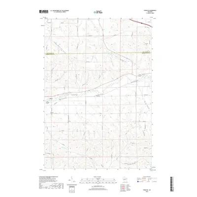
2018 Map of Strum SE
USGS Topo · Published 2018About this map
Strum sits at the edge of this terrain where the Buffalo River is paralleled by the Buffalo River State Trail. The landscape is defined by its deep drainages, including Rumstead Valley and Kings Valley, which dictate the placement of rural roads and homesteads. Local history and genealogy are centered around the West Beef River Cem and Prairie View Cem, while the Brion Memorial Airport serves as a small aviation landmark in the river valley. The map documents the intricate network of creeks like Pine Cr and Johnson Valley Cr that feed the river system, along with named corridors such as Holman Valley. This topographic survey shows how the county line between Eau Claire Co and Trempealeau Co follows the natural ridges and section lines of this agricultural region.
Find a feature on this map
41 named features on this map. Tap any name to fly to it.
Don’t see what you’re looking for? This feature index may not catch every label — zoom into the map to look around manually.
Map Details
Editions of this 2018 Strum SE Map
This is the sole edition of this map. No revisions or reprints were ever made.
Other maps of this area

1926 · Whitehall
USGS Topo · 1:62,500

1927 · Blair
USGS Topo · 1:62,500

1927 · Strum
USGS Topo · 1:62,500

1929 · Whitehall
USGS Topo · 1:62,500

1930 · Strum
USGS Topo · 1:62,500

1935 · Osseo
USGS Topo · 1:48,000

1940 · Osseo
USGS Topo · 1:62,500

1953 · Eau Claire
USGS Topo · 1:250,000

1958 · Eau Claire
USGS Topo · 1:250,000

1964 · Eau Claire
USGS Topo · 1:250,000