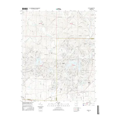
2017 Map of Stuart
USGS Topo · Published 2017About this map
Cherokee Village occupies the center of this landscape, defined by a complex network of artificial reservoirs and suburban development along the South Fork Spring River. The community’s layout is deeply intertwined with its geography, where residential streets wind around significant water bodies such as Lake Thunderbird, Lake Omaha, and Lake Chanute. This modern development contrast with the older rural character found in surrounding hollows like Bee Gum Hollow and Good Spring Hollow.
Find a feature on this map
304 named features on this map. Tap any name to fly to it.
Don’t see what you’re looking for? This feature index may not catch every label — zoom into the map to look around manually.
Map Details
Editions of this 2017 Stuart Map
This is the sole edition of this map. No revisions or reprints were ever made.
Other maps of this area

1957 · Poplar Bluff
USGS Topo · 1:250,000

1959 · Poplar Bluff
USGS Topo · 1:250,000

1960 · Poplar Bluff
USGS Topo · 1:250,000

1962 · Stuart
USGS Topo · 1:24,000

1962 · Ash Flat
USGS Topo · 1:24,000

1962 · Myron
USGS Topo · 1:24,000

1962 · Agnos
USGS Topo · 1:24,000

1962 · Mammoth Spring
USGS Topo · 1:24,000
1962 · Camp
USGS Topo · 1:24,000

1968 · Hardy
USGS Topo · 1:24,000