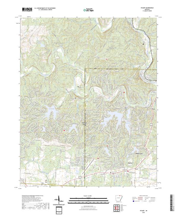
2024 Map of Stuart
USGS Topo · Published 2024About this map
Cherokee Village and the surrounding Ozark foothills in Fulton and Sharp counties are defined by an intricate network of planned residential streets and man-made lakes. Established mid-century as a resort and retirement community, the area features significant water bodies like Lake Omaha, Lake Cherokee, and Lake Sequoyah, which are interconnected by seasonal creeks and hollows such as Good Spring Hollow and Bee Gum Hollow. The southern portion of the map transitions into the more established community of Ash Flat, where Ozarka College and the Sharp County Regional Airport serve as regional anchors.
Find a feature on this map
305 named features on this map. Tap any name to fly to it.
Don’t see what you’re looking for? This feature index may not catch every label — zoom into the map to look around manually.
Map Details
Editions of this 2024 Stuart Map
This is the sole edition of this map. No revisions or reprints were ever made.
Other maps of this area

1957 · Poplar Bluff
USGS Topo · 1:250,000

1959 · Poplar Bluff
USGS Topo · 1:250,000

1960 · Poplar Bluff
USGS Topo · 1:250,000

1962 · Stuart
USGS Topo · 1:24,000

1962 · Ash Flat
USGS Topo · 1:24,000

1962 · Myron
USGS Topo · 1:24,000

1962 · Agnos
USGS Topo · 1:24,000

1962 · Mammoth Spring
USGS Topo · 1:24,000
1962 · Camp
USGS Topo · 1:24,000

1968 · Hardy
USGS Topo · 1:24,000