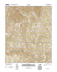
2013 Map of Stuart SE
USGS Topo · Published 2013About this map
Peters Creek and Collinstown anchor this rural landscape along the Virginia and North Carolina border, where the headwaters of the Dan River meet the rising foothills of the Blue Ridge. The area is defined by a network of winding waterways including Elk Cr, Little Peters Cr, and Beaverdam Cr, which carve through a terrain punctuated by Willard Mountain and Beans Knob. The settlement pattern follows these creek valleys, with small community hubs like Aarons Corner and Harts Store serving as historical waypoints for the surrounding farmsteads. Roadways such as Rocky Branch Ln and Shingle Shop Rd hint at the local industries and family names that shaped the region’s development. The map also captures the transition from Virginia into North Carolina near Francisco, illustrating the persistent rural character of the Piedmont's upper reaches in the early twenty-first century.
Find a feature on this map
122 named features on this map. Tap any name to fly to it.
Don’t see what you’re looking for? This feature index may not catch every label — zoom into the map to look around manually.
Map Details
Editions of this 2013 Stuart SE Map
This is the sole edition of this map. No revisions or reprints were ever made.
Other maps of this area

1926 · Critz
USGS Topo · 1:48,000

1928 · Stuart
USGS Topo · 1:48,000

1928 · Critz
USGS Topo · 1:62,500

1931 · Stuart
USGS Topo · 1:62,500

1953 · Winston-Salem
USGS Topo · 1:250,000

1955 · Winston-Salem
USGS Topo · 1:250,000

1962 · Winston-Salem
USGS Topo · 1:250,000

1964 · Hanging Rock
USGS Topo · 1:24,000

1964 · Pilot Mountain
USGS Topo · 1:24,000

1967 · Patrick Springs
USGS Topo · 1:24,000