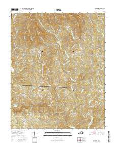
2016 Map of Stuart SE
USGS Topo · Published 2016About this map
The Dan River winds through this borderland where Patrick County, Virginia, meets Stokes County, North Carolina. Small agricultural communities and family-named landmarks define the landscape, from Francisco in the south to the higher elevations of Carter Mtn and Pikes Mtn near the northern boundary. The area is marked by a dense network of country roads like Elastic Plant Rd and Brushy Mountain Rd, which connect rural centers such as Peters Creek, Harts Store, and Aarons Corner.
Find a feature on this map
109 named features on this map. Tap any name to fly to it.
Don’t see what you’re looking for? This feature index may not catch every label — zoom into the map to look around manually.
Map Details
Editions of this 2016 Stuart SE Map
This is the sole edition of this map. No revisions or reprints were ever made.
Other maps of this area

1926 · Critz
USGS Topo · 1:48,000

1928 · Stuart
USGS Topo · 1:48,000

1928 · Critz
USGS Topo · 1:62,500

1931 · Stuart
USGS Topo · 1:62,500

1953 · Winston-Salem
USGS Topo · 1:250,000

1955 · Winston-Salem
USGS Topo · 1:250,000

1962 · Winston-Salem
USGS Topo · 1:250,000

1964 · Hanging Rock
USGS Topo · 1:24,000

1964 · Pilot Mountain
USGS Topo · 1:24,000

1967 · Patrick Springs
USGS Topo · 1:24,000