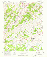
1964 Map of Stuarts Draft
USGS Topo · Published 1972About this map
Stuarts Draft serves as the focal point of this Shenandoah Valley landscape, situated where the Norfolk and Western railway corridor meets the South River. The terrain transitions from the cleared agricultural lands of White Hill and Barterbrook to the dense timber of the George Washington National Forest in the south. The map documents a period of suburban transition in the early 1970s, evidenced by purple revision layers showing new residential developments near Joliyue and Brookwood. Local history and genealogy interest is high here, with numerous rural landmarks including Hattons Ch, Good Shepherd Ch, and the Oak Grove Ch near Lewis Creek. Cultural shifts are further noted by the presence of a Drive-in Theater (Abandoned) located along the main thoroughfare. The drainage patterns of Christians Creek and Folly Mills Creek define the low-lying valleys between prominent rises like Chestnut Ridge and Round Hill.
Find a feature on this map
47 named features on this map. Tap any name to fly to it.
Don’t see what you’re looking for? This feature index may not catch every label — zoom into the map to look around manually.
Map Details
Editions of this 1964 Stuarts Draft Map
3 editions found
Other maps of this area

1892 · Buckingham
USGS Topo · 1:125,000

1892 · Harrisonburg
USGS Topo · 1:125,000

1894 · Staunton
USGS Topo · 1:125,000

1894 · Lexington
USGS Topo · 1:125,000

1934 · Waynesboro
USGS Topo · 1:48,000

1936 · Vesuvius
USGS Topo · 1:48,000

1939 · Waynesboro
USGS Topo · 1:62,500

1941 · Vesuvius
USGS Topo · 1:62,500

1943 · Lovingston
USGS Topo · 1:62,500

1944 · Staunton
USGS Topo · 1:62,500