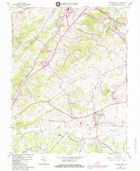
1964 Map of Stuarts Draft
USGS Topo · Published 1984About this map
The South River and Christians Creek drainage systems define this mid-1960s landscape in Augusta County, where the industrial expansion of Stuarts Draft meets the wooded foothills of the George Washington National Forest. The map documents a period of significant transition, capturing the intersection of the Norfolk and Western and Chesapeake and Ohio railroads as they supported local industry and agriculture. Smaller settlements like Mint Spring, Jolivue, and Folly Mills appear alongside numerous rural landmarks including Oak Grove Ch and Finley Mem Ch.
Find a feature on this map
49 named features on this map. Tap any name to fly to it.
Don’t see what you’re looking for? This feature index may not catch every label — zoom into the map to look around manually.
Map Details
Editions of this 1964 Stuarts Draft Map
3 editions found
Other maps of this area

1892 · Buckingham
USGS Topo · 1:125,000

1892 · Harrisonburg
USGS Topo · 1:125,000

1894 · Staunton
USGS Topo · 1:125,000

1894 · Lexington
USGS Topo · 1:125,000

1934 · Waynesboro
USGS Topo · 1:48,000

1936 · Vesuvius
USGS Topo · 1:48,000

1939 · Waynesboro
USGS Topo · 1:62,500

1941 · Vesuvius
USGS Topo · 1:62,500

1943 · Lovingston
USGS Topo · 1:62,500

1944 · Staunton
USGS Topo · 1:62,500