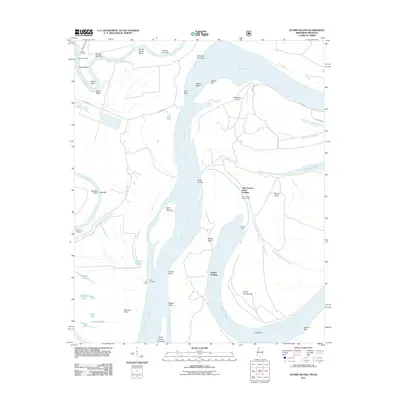
2011 Map of Stubbs Island
USGS Topo · Published 2011About this map
The confluence of the Saint Francis River and the Mississippi River creates a dynamic landscape of shifting channels, sandbars, and oxbow remnants along the Arkansas-Mississippi border. Small river-oriented settlements and access points like Grants Landing, Osborn Landing, and Tate Landing line the banks, reflecting the historical importance of water-based transport in Lee County. The interior is dotted with numerous small bodies of water including Cannon Lake, Laddie Lake, and Forked Lake, which appear as fragments of former river paths now isolated by the levee and drainage systems.
Find a feature on this map
49 named features on this map. Tap any name to fly to it.
Don’t see what you’re looking for? This feature index may not catch every label — zoom into the map to look around manually.
Map Details
Editions of this 2011 Stubbs Island Map
This is the sole edition of this map. No revisions or reprints were ever made.
Other maps of this area

1908 · Dundee
USGS Topo · 1:24,000

1910 · Dundee
USGS Topo · 1:31,680

1931 · Horseshoe Lake
USGS Topo · 1:62,500

1939 · Clayton
USGS Topo · 1:62,500

1939 · Horseshoe Lake
USGS Topo · 1:62,500

1939 · Park Place
USGS Topo · 1:62,500

1939 · Latour
USGS Topo · 1:62,500

1948 · Helena
USGS Topo · 1:250,000

1950 · Helena
USGS Topo · 1:250,000

1954 · Horseshoe Lake
USGS Topo · 1:62,500
Featured Places
- Saint Francis Island Landing, AR
- Harbert Landing, MS
- Phillips County, AR
- Tunica County, MS
- Lee County, AR