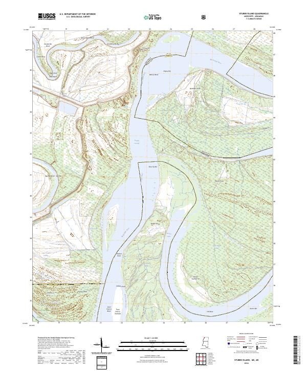
2024 Map of Stubbs Island
USGS Topo · Published 2024About this map
Mississippi River dynamics define this stretch of the border between Arkansas and Mississippi, where the river's shifting path has created a complex network of bars, bends, and chutes. The central feature, Stubbs Island, sits adjacent to the meandering Tunica Lake, while the Hardin Cut-Off illustrates the engineering and natural forces that have altered the river's main channel over time. To the west, the Saint Francis National Forest protects the lowlands between the Saint Francis River and the big river, preserving a landscape of oxbows and swampy depressions like Gober Lake and Laddie Lake.
Find a feature on this map
59 named features on this map. Tap any name to fly to it.
Don’t see what you’re looking for? This feature index may not catch every label — zoom into the map to look around manually.
Map Details
Editions of this 2024 Stubbs Island Map
This is the sole edition of this map. No revisions or reprints were ever made.
Other maps of this area

1908 · Dundee
USGS Topo · 1:24,000

1910 · Dundee
USGS Topo · 1:31,680

1931 · Horseshoe Lake
USGS Topo · 1:62,500

1939 · Clayton
USGS Topo · 1:62,500

1939 · Horseshoe Lake
USGS Topo · 1:62,500

1939 · Park Place
USGS Topo · 1:62,500

1939 · Latour
USGS Topo · 1:62,500

1948 · Helena
USGS Topo · 1:250,000

1950 · Helena
USGS Topo · 1:250,000

1954 · Horseshoe Lake
USGS Topo · 1:62,500
Featured Places
- Harbert Landing, MS
- Saint Francis Island Landing, AR
- Phillips County, AR
- Tunica County, MS
- Lee County, AR