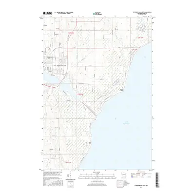
2015 Map of Sturgeon Bay East
USGS Topo · Published 2015About this map
Sturgeon Bay sits at the nexus of the Door Peninsula's maritime landscape, dominated by the vital Sturgeon Bay Ship Canal that links the bay to Lake Michigan. This 2015 record shows the city's eastern expansion toward the coast, where rocky points and sandy bays define the shoreline. Local heritage is grounded in sites like Saint Joseph Cem and the prominent Stevens Hill, while the northern interior remains a mix of forest and wetland.
Find a feature on this map
120 named features on this map. Tap any name to fly to it.
Don’t see what you’re looking for? This feature index may not catch every label — zoom into the map to look around manually.
Map Details
Editions of this 2015 Sturgeon Bay East Map
This is the sole edition of this map. No revisions or reprints were ever made.
Other maps of this area

1954 · Manitowoc
USGS Topo · 1:250,000

1958 · Manitowoc
USGS Topo · 1:250,000

1960 · Sturgeon Bay
USGS Topo · 1:62,500

1960 · Jacksonport
USGS Topo · 1:62,500

1960 · Algoma
USGS Topo · 1:62,500

1981 · Sturgeon Bay West
USGS Topo · 1:24,000

1981 · Institute
USGS Topo · 1:24,000
1981 · Idlewild
USGS Topo · 1:24,000
1981 · Sturgeon Bay East
USGS Topo · 1:24,000
1982 · Jacksonport
USGS Topo · 1:24,000