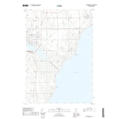
2018 Map of Sturgeon Bay East
USGS Topo · Published 2018About this map
The Sturgeon Bay Ship Canal serves as the central geographic feature of this eastern Door County landscape, providing a critical maritime link between the waters of Sturgeon Bay and Lake Michigan. The map illustrates the residential development of the city's east side, where streets like Rhode Island St and Memorial Dr terminate near the canal's edge. Beyond the urban grid, the terrain rises toward Stevens Hill and Mt Lowe, while the coastline is defined by prominent landmarks such as Portage Point and Rocky Point. Genealogists will find the Saint Joseph Cem situated along Egg Harbor Rd, a key historical artery in the region. The map also traces the drainage patterns of Geisel Creek and Big Creek, which flow through the marshy lowlands near Lilly Bay.
Find a feature on this map
61 named features on this map. Tap any name to fly to it.
Don’t see what you’re looking for? This feature index may not catch every label — zoom into the map to look around manually.
Map Details
Editions of this 2018 Sturgeon Bay East Map
This is the sole edition of this map. No revisions or reprints were ever made.
Other maps of this area

1954 · Manitowoc
USGS Topo · 1:250,000

1958 · Manitowoc
USGS Topo · 1:250,000

1960 · Sturgeon Bay
USGS Topo · 1:62,500

1960 · Jacksonport
USGS Topo · 1:62,500

1960 · Algoma
USGS Topo · 1:62,500

1981 · Sturgeon Bay West
USGS Topo · 1:24,000

1981 · Institute
USGS Topo · 1:24,000
1981 · Idlewild
USGS Topo · 1:24,000
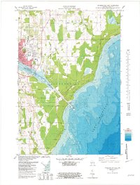
1981 · Sturgeon Bay East
USGS Topo · 1:24,000
1982 · Jacksonport
USGS Topo · 1:24,000