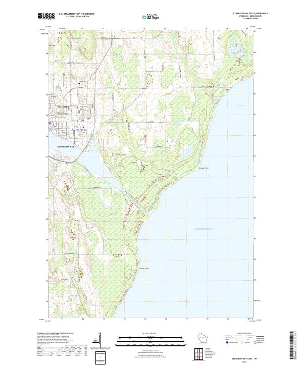
2022 Map of Sturgeon Bay East
USGS Topo · Published 2022About this map
The Sturgeon Bay Ship Canal serves as the focal point of this Door County coastal landscape, carving a vital maritime passage between the western waters and Lake Michigan to the east. The eastern side of the city of Sturgeon Bay is densely mapped with a grid of residential and commercial streets, including the campus of the Northeast Wisconsin Technical College. Rising above the urban layout is Stevens Hill, while the outlying areas transition into a mosaic of wetlands and timbered tracts. Along the Lake Michigan shoreline, distinctive geographical features like Portage Point, Rocky Point, and the broad curve of Lilly Bay define the coast. Local history and genealogy interests are anchored by landmarks such as the Saint Joseph Cem and family-named routes like Jorns Ln and Petersor Rd, providing a detailed look at the interface between established maritime infrastructure and the rugged peninsula terrain.
Find a feature on this map
95 named features on this map. Tap any name to fly to it.
Don’t see what you’re looking for? This feature index may not catch every label — zoom into the map to look around manually.
Map Details
Editions of this 2022 Sturgeon Bay East Map
This is the sole edition of this map. No revisions or reprints were ever made.
Other maps of this area

1954 · Manitowoc
USGS Topo · 1:250,000

1958 · Manitowoc
USGS Topo · 1:250,000

1960 · Sturgeon Bay
USGS Topo · 1:62,500

1960 · Jacksonport
USGS Topo · 1:62,500

1960 · Algoma
USGS Topo · 1:62,500

1981 · Sturgeon Bay West
USGS Topo · 1:24,000

1981 · Institute
USGS Topo · 1:24,000
1981 · Idlewild
USGS Topo · 1:24,000
1981 · Sturgeon Bay East
USGS Topo · 1:24,000
1982 · Jacksonport
USGS Topo · 1:24,000