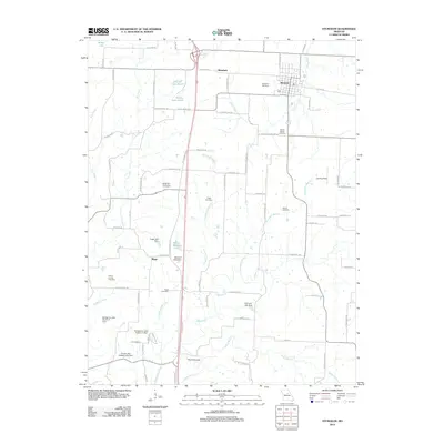
2012 Map of Sturgeon
USGS Topo · Published 2012About this map
The settlement of Sturgeon sits at a historic crossroads in northern Missouri, where a concentrated grid of streets meets the surrounding agricultural landscape. This 2012 survey illustrates a region defined by its numerous small-scale reservoirs and dams, such as David Bailey Lake and Bumgarner Lake Section 3 Dam, which managed the local hydrology of the Silver Fork and Grindstone Branch. To the west, the community of Riggs remains a distinct geographic point near Mount Carmel Cemetery, while the northern village of Bourbon serves as another focal point for the surrounding rural roads. The southern portion of the area is anchored by a significant natural feature known as The Pinnacles, located near the confluence of Kelley Branch and the Silver Fork. This map serves as an essential record for those studying the genealogical history of Boone County, documenting numerous family and community burial grounds including Palmer Cemetery and Mount Horeb Cemetery.
Find a feature on this map
83 named features on this map. Tap any name to fly to it.
Don’t see what you’re looking for? This feature index may not catch every label — zoom into the map to look around manually.
Map Details
Editions of this 2012 Sturgeon Map
This is the sole edition of this map. No revisions or reprints were ever made.
Other maps of this area

1890 · Moberly
USGS Topo · 1:125,000

1917 · Sturgeon
USGS Topo · 1:62,500

1945 · Centralia
USGS Topo · 1:62,500

1953 · Moberly
USGS Topo · 1:250,000

1953 · Renick
USGS Topo · 1:24,000

1953 · Clark
USGS Topo · 1:24,000

1954 · Moberly
USGS Topo · 1:250,000

1957 · Moberly
USGS Topo · 1:250,000

1958 · Tulip
USGS Topo · 1:24,000

1960 · Moberly
USGS Topo · 1:250,000