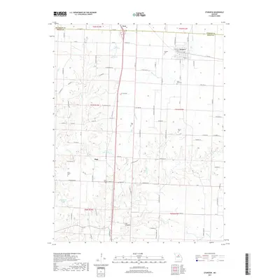
2017 Map of Sturgeon
USGS Topo · Published 2017About this map
Sturgeon and the surrounding farmland of Boone County are defined by a network of rural roads and small family cemeteries that mark the late 20th-century landscape. The northern edge of the map follows the intersection of three counties — Boone, Audrain, and Randolph — where the community of Clark straddles the boundary. Small-scale water features like Tincher Lake South and David Bailey Lake are interspersed with the winding courses of Saling Cr and Silver Fork.
Find a feature on this map
65 named features on this map. Tap any name to fly to it.
Don’t see what you’re looking for? This feature index may not catch every label — zoom into the map to look around manually.
Map Details
Editions of this 2017 Sturgeon Map
This is the sole edition of this map. No revisions or reprints were ever made.
Other maps of this area
1890 · Moberly
USGS Topo · 1:125,000
1917 · Sturgeon
USGS Topo · 1:62,500
1945 · Centralia
USGS Topo · 1:62,500
1953 · Moberly
USGS Topo · 1:250,000
1953 · Renick
USGS Topo · 1:24,000
1953 · Clark
USGS Topo · 1:24,000
1954 · Moberly
USGS Topo · 1:250,000
1957 · Moberly
USGS Topo · 1:250,000
1958 · Tulip
USGS Topo · 1:24,000
1960 · Moberly
USGS Topo · 1:250,000